![]()
CQC
![]()
CQC

Stats:
This just in from ABØCD--
===FLASH===
Colorado QRP Club bests all QRP teams in ARRL Field Day 2003
CQC Finishes 8th Overall
RAMPART RANGE, Colorado The Colorado QRP Club, true to form, was the top QRP finisher during this year's ARRL Field Day operations, with 12,750 points.
CQC won the 2A-Battery class. There were 29 teams participating in this class.
The point score placed CQC in 8ths place nationally, out of 2,058 teams submitting logs. Only QRO operations placed ahead of the club.
The seven teams placing ahead of CQC had from 14 to 73 operators. CQC did it with six.
Unfortunately, Field Day IS NOT at contest. But way to go CQC!
Soapbox:
Comments DE N1FN--
I didn't participate in CQC's FD operation this year so can't share in the glory, but congratulate the guys on a job well done. CQC holds the all time record in both the 2A and 3A classes, and the results are a dramatic illustration of what you can do with QRP power, even under "field conditions." OK, CW contacts count double, and there's a bonus for low power, but still-- 8th overall is not too shabby. Dick notes that we placed above all other QRP stations, but I think it is more significant that only 7 QRO stations did better!
This portion of the page is how we announced our 2003 Field Day effort:
WHO:
The Colorado QRP Club and most of this Hemisphere's active amateurs!!
WHAT:
Our 2003 "Competitive" Field Day effort will take place
at our Rampart Range site in the foothills of the Colorado Rockies
(2002 Forest Fires forced us to move the operation out on the high plains last year...)
WHEN:
Friday-Saturday-Sunday June 27, 28 & 29, 2003.
Set-up begins Noon Friday June 27th. Field Day Event: Noon Saturday to Noon Sunday.
Tear-down Sunday afternoon.
WHERE:
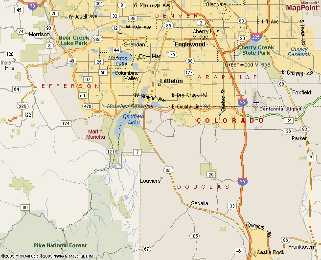
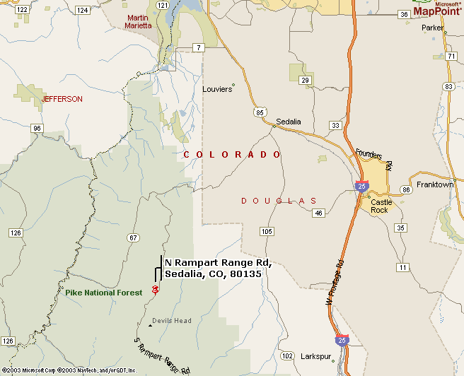
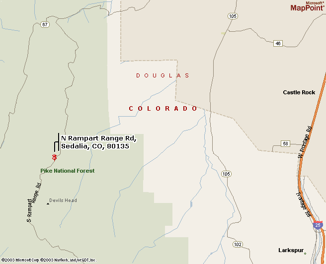
Rampart Range Road near Sedalia, Colorado (About 40 miles southwest of Denver)
Located on huge ridge, at 8,000 feet elevation, in the Pike National Forest
Clear views in almost every direction with great 2 meter line-of-site into Denver
Maps:
Note: Devil's Head is the last operational lookout on the Front Range and sits on the highest point of the Rampart Range.
The Devil's Head tower is accessible by the 1.3 mile long Devil's Head National Recreation Trail.
FACILITIES:
Parking and campsite.
STATIONS (This could change anytime before contest time!):
2A (2 HF stations)
primarly focused on 80-20m
Talk-in 147.225 Repeater, 146.445 Simplex.
CONTACT: Al Dawkins, our Field Day Chairman, can be reached at alkøfrp@attbi.com for all kinds of additional information!
WHAT ELSE:
Bring your Fun!
 Return to our main Field Day page
Return to the CQC Photo Gallery Index
Return to CQC Home Page
About |
Contact |
Home |
Join |
Meetings
&
Events |
Members |
Merchandise |
Newsletter |
Site
Index |
Copyright
© 1994 -